River Trym
The River Trym is a short river, some 4.5 miles (7.2 km) in length, which rises in Filton, South Gloucestershire, England. The upper reaches are culverted, some underground, through mostly urban landscapes, but once it emerges into the open it flows through a nature reserve and city parks before joining the tidal River Avon at Sea Mills. 18th-century water mills near the mouth gave the area its name.
Portus Abonae was a Roman port at the mouth which provided an embarkation point for journeys across the River Severn to South Wales. In the 18th century there were short lived attempts at creating a port and a whale fishery here. The name Trym appears to have Anglo-Saxon roots. In recent years silting problems, caused by urban development, have caused some difficulties, but alleviation works have helped reduce the problem.
The Trym rises near Filton in South Gloucestershire, in the area of Filton Golf Club. and much of its upper course is culverted underneath 20th century housing. It surfaces in the Bristol suburb of Southmead, then flows open through Badock’s Wood nature reserve.[1] Just south of here is Henleaze Swimming Lake, a former quarry fed by springs, the overflow running into the Trym.[2] The river is culverted through Westbury-on-Trym village. A sluice here is used to divert water into a storm drain in times of high rainfall to save the village centre from flooding.[1]
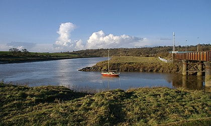
The Trym then disappears into culverts, re-emerging at Henbury Golf Club before entering the Blaise Castle estate, where it is joined on the right bank by the Hazel Brook above Coombe Dingle. The remains of Coombe Mill, which was fed by both the Hazel Brook and the Trym, can be seen here. Passing under Dingle Road bridge, the river then flows through Sea Mills river park, passing under the Portway and the Severn Beach railway line before joining the river Avon. A weir under the Portway prevents flooding upstream, except during the highest spring tides.[1]