River Lyde (Hampshire)
The River Lyde or Lyde River is a small river in the English county of Hampshire. It rises near Mapledurwell, where the water is used in watercress beds before entering the main channel. It flows in a generally northerly direction, and used to supply power to watermills along its route. Near Sherfield on Loddon it joins the River Loddon, which is a tributary of the River Thames.
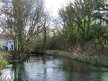
The Lyde River rises as a series of springs on the chalk aquifer to the west of Mapledurwell. Almost immediately, it runs through a number of watercress beds, which are part of Huish Farm. The main house was built in 1909 for the Westray family, in Domestic Revival style, with a red brick ground floor, timber framing on the first floor, and an attic above that. Most of the internal features are in original condition. It is a grade II listed structure,[1] as are the associated barn and granary. To the north of the farm, the river is crossed by the M3 motorway, but the bridge marks the location where the Basingstoke Canal once crossed, on its way to Basingstoke. The canal was never a commercial success, and the last boats to use this section did so in 1914. The section further east continued to be used until 1949, but when restoration began in the 1970s, progress was hampered by the partial collapse of the Greywall Tunnel, and the fact that the largest population of bats in Europe use it for hibernation in the winter. The construction of the M3 motorway sealed the fate of the western section.[2]
Beyond the motorway, there are a network of drains and springs, which swell the flow, before it turns to the east to reach Priory Farm at Andwell. This was the site of St Mary’s Priory from around 1130 until 1391, when it was dissolved. It was an alien priory, under the control of the Tironensian Order in France. Parts of the priory have been incorporated into Priory Farmhouse, a grade I listed building, which was altered and extended in the 17th and 19th centuries.[3] The adjacent barn, stable and cartshed are also listed structures. The river passes around the southern edge of the site, and is joined by another stream, which rises by the grade II* listed church of St Mary, Mapledurwell, which dates from the 13th and 15th centuries, with 19th century restorations.[4] The spring is at 242 feet (74 m) above Ordnance datum,[5] from which the stream weaves its way northwards, on both sides of Frog Lane, and there are more watercress beds, either side of the former course of the canal, before it passes under Greywell Road and the motorway to reach the main waterway.[6]