Lake Titicaca
Lake Titicaca (/tɪtɪˈkɑːkə/;[4] Spanish: Lago Titicaca [ˈlaɣo titiˈkaka]; Quechua: Titiqaqa Qucha) is a large, deep, freshwater lake in the Andes on the border of Bolivia and Peru, often called the “highest navigable lake” in the world. By volume of water and by surface area, it is the largest lake in South America.[5][6][7] (Lake Maracaibo has a larger surface area, but it is a tidal bay, not a lake.)
Lake Titicaca has a surface elevation of 3,812 m (12,507 ft). The “highest navigable lake” claim is generally considered to refer to commercial craft. Numerous smaller bodies of water around the world are at higher elevations.[10] For many years, the largest vessel afloat on the lake was the 2,200-ton (2,425 U.S. tons), 79-metre (259 ft) SS Ollanta. Today, the largest vessel is most likely the similarly sized train barge/float Manco Capac, operated by PeruRail.
Other cultures lived on Lake Titicaca prior to the arrival of the Incas. In 2000, a team of international archaeologists and divers found the ruins of an underwater temple, thought to be between 1,000 and 1,500 years old, most likely built by the Tiwanaku people. The ruins have been measured to be 200 by 50 m (660 by 160 ft). The temple was accompanied by a village, some roads, terraces for farming and a retaining wall that ran for 800 meters.
The lake is located at the northern end of the endorheic Altiplano basin high in the Andes on the border of Peru and Bolivia. The western part of the lake lies within the Puno Region of Peru, and the eastern side is located in the Bolivian La Paz Department.
The lake consists of two nearly separate subbasins connected by the Strait of Tiquina, which is 800 m (2,620 ft) across at the narrowest point. The larger subbasin, Lago Grande (also called Lago Chucuito), has a mean depth of 135 m (443 ft) and a maximum depth of 284 m (932 ft). The smaller subbasin, Wiñaymarka (also called Lago Pequeño, “little lake”), has a mean depth of 9 m (30 ft) and a maximum depth of 40 m (131 ft).[14] The overall average depth of the lake is 107 m (351 ft).
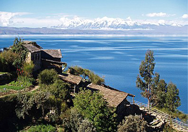
Five major river systems feed into Lake Titicaca. In order of their relative flow volumes these are Ramis, Coata, Ilave, Huancané, and Suchez.[5] More than 20 other smaller streams empty into Titicaca. The lake has 41 islands, some of which are densely populated.
Having only a single season of free circulation, the lake is monomictic, and water passes through Lago Huiñaimarca and flows out the single outlet at the Río Desaguadero,[18] which then flows south through Bolivia to Lake Poopó. This only accounts for about 10% of the lake’s water balance. Evapotranspiration, caused by strong winds and intense sunlight at high altitude, balances the remaining 90% of the water loss. It is nearly a closed lake.
Since 2000, Lake Titicaca has experienced constantly receding water levels. Between April and November 2009 alone, the water level dropped by 81 cm (32 in), reaching the lowest level since 1949. This drop is caused by shortened rainy seasons and the melting of glaciers feeding the tributaries of the lake.
Water pollution is also an increasing concern because cities in the Titicaca watershed grow, sometimes outpacing solid waste and sewage treatment infrastructure.[22] According to the Global Nature Fund (GNF), Titicaca’s biodiversity is threatened by water pollution and the introduction of new species by humans.[23] In 2012, the GNF nominated the lake “Threatened Lake of the Year”.