River Don, Yorkshire
The River Don (also called River Dun in some stretches) is a river in South Yorkshire and the East Riding of Yorkshire, England. It rises in the Pennines, west of Dunford Bridge, and flows for 70 miles (110 km) eastwards, through the Don Valley, via Penistone, Sheffield, Rotherham, Mexborough, Conisbrough, Doncaster and Stainforth. It originally joined the Trent, but was re-engineered by Cornelius Vermuyden as the Dutch River in the 1620s, and now joins the River Ouse at Goole. Don Valley is a UK parliamentary constituency near the Doncaster stretch of the river.
The probable origin of the name was Brittonic Dānā, from a root dān-, meaning “water” or “river”.[1] The name Dôn (or Danu), a Celtic mother goddess, has the same origin.
The river gave its name to the Don River, one of the principal rivers of Toronto, Canada.
The Don can be divided into sections by the different types of structures built to restrict its passage. The upper reaches, and those of several of its tributaries, are defined by dams built to provide a public water supply. The middle section contains many weirs, which were built to supply mills, foundries and factories with water power, while the lower section contains weirs and locks, designed to maintain water levels for navigation. The Don’s major tributaries are the Loxley, the Rivelin, the Sheaf, the Rother and the Dearne.
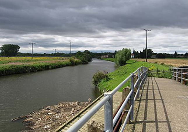
Along the Sheffield–Rotherham stretch of the river are five weirs that punctuate a local walking and cycling route, the Five Weirs Walk. A further walk, the Upper Don Walk, is being developed that will make it possible to walk or cycle from Sheffield city centre up to Oughtibridge.
Below Doncaster, the main channel of the lower Don originally meandered in a north-easterly direction across the marshland of Hatfield Chase to enter the Trent just above its junction with the Ouse. A second channel flowed to the north, along a Roman channel called Turnbridgedike. The eastern channel formed the boundary between Yorkshire and Lincolnshire.
In the Hatfield Level drainage project which started in 1626, the Dutch civil engineer Cornelius Vermuyden diverted the Don northwards along Turnbridgedike. He constructed Dikesmarsh bank some distance to the east of the channel, so that the intervening land could be used as washlands. The main work was completed by 1628, but after flooding in 1629, a “Great Sluice” was constructed at the junction between the river and the Aire, with 17 openings which were 6 by 8 feet (1.8 by 2.4 m), probably by Hugo Spiering, who had assisted Vermuyden on the main project. The washlands had insufficient capacity, and in 1632 work started on a new channel, which would run for 5 miles (8.0 km) from Newbridge, near Thorne, eastwards to enter the Ouse at the site of Goole, 9 miles (14 km) upstream of the Trent. Water levels here were between 5 and 10 feet (1.5 and 3.0 m) lower than at Turnbridge. This new channel was called the “Dutch River”, and was finished in 1635, at a cost of £33,000. It ended in a sluice at Goole, and was never intended to be navigable, as boats could access the Aire at Turnbridge.[2] The sluice was later swept away in a flood and never replaced.
The Dutch River was difficult to navigate, made more hazardous by shoals, three awkward bridges, and low water levels at neap tides. With the opening of the Stainforth and Keadby Canal in 1802, from the Don at Stainforth to the Trent at Keadby, most traffic for the Trent used that in preference to the Dutch River and the route around Trent Falls, where the Trent joins the Humber.[4] Construction of a railway from Doncaster to Goole in 1869 reduced traffic on the river, but the Sheffield and South Yorkshire Navigation Company was formed in 1889, to buy back the River Don Navigation, the Sheffield Canal and the Stainforth and Keadby Canal from railway ownership, to keep them competitive. They acquired the waterways in 1895, but failed to raise sufficient capital for the major improvements they had planned. However, they succeeded in constructing the New Junction Canal from Stainforth to the Aire and Calder Navigation (Knottingley and Goole Canal) west of Goole, which was jointly funded by the Aire and Calder, and opened in 1905. The Dutch River reverted almost entirely to its original drainage function, and Stainforth lock, which connected it to the Stainforth and Keadby Canal, was closed in 1939.