Durango
Durango (Spanish pronunciation: [duˈɾaŋɡo] (About this soundlisten)), officially named Free and Sovereign State of Durango (Spanish: Estado Libre y Soberano de Durango; Tepehuán: Korian; Nahuatl: Tepēhuahcān), is one of the 31 states which make up the 32 Federal Entities of Mexico, situated in the northwest of the country. With a population of 1,832,650, Durango has Mexico’s second-lowest population density, after Baja California Sur. The capital city, Victoria de Durango, is named after the first president of Mexico, Guadalupe Victoria.
With 123,451.2 km2 or 12.3 million ha, Durango accounts for about 6.3% of the entire territory of Mexico. It is the fourth largest state[9][10] lying at the extreme northwest of the Central Mexican Plateau, where it meets the Sierra Madre Occidental—the highest peaks in the state. The state has an average elevation of 1,775 meters above sea level, with a mean elevation of 1,750 m in the Valleys region and 2,450 m in the Sierra region.[11] The city of Durango is on the foothills of the Sierra Madre Occidental, with an elevation of 1,857 m.[12]
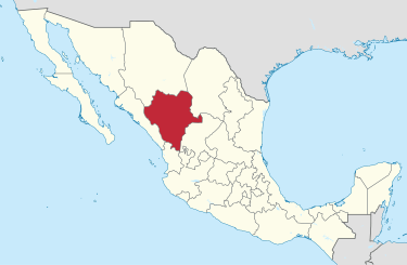
Durango is landlocked, bordered by Chihuahua, Coahuila, Zacatecas, Nayarit and Sinaloa.[9][10] It is divided into 39 municipalities,[13] based on the 1917 Constitution of Mexico, and several additional divisions have been made since.[14]
The Sierra Madre Occidental blocks moisture from the Pacific Ocean, impacting the local climate of the state. Las Quebradas region, located over the mountain chain and on the northwest of the state, has a humid subtropical climate. Excepting the highest elevations, the rest of the state has semi-arid and temperate climates. It is hot and dry in the East, with some temperate areas existing at higher elevations.[9]