Jalangi River
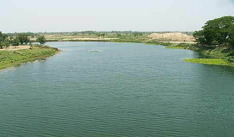
Jalangi River (Bengali: জলঙ্গী নদী), is a branch of the Ganges river in Murshidabad and Nadia districts in the Indian state of West Bengal. It flows into the Bhagirathi river and strengthens its lower channel, the Hooghly.[1]
The river below the point where the Jalangi meets the Ganges is known as Hooghly and the course above it from the point of its separation from the main flow of the Ganges to its confluence with the Jalangi, it is called Bhagirathi.[2]
Ghurni, a neighbourhood of Krishnanagar, a centre for the production of clay dolls, often referred to as Krishnanagar clay dolls, is located on the banks of the Jalangi. Nabadwip, the birthplace of Chaitanya Mahaprabhu is located in the west bank of the united flow of river Jalangi and Bhagirathi.[3] Mayapur is located at the confluence of the Jalanagi and Bhagirathi.
The name Jalangi derives from two Bengali words Jal (Water) and Angi (who (female) posses body). ‘Jalangi’ is a Bengali word meaning ‘watery body’ or ‘the body is made of water’.[4] However, the name ‘Jalangi’ has been derived from that very settlement ‘Jalangi’ in P.S. Jalangi of Murshidabad district, at which, the river would take-off its supply from river Padma (Majumder, 1995, p-37)
The Jalangi is a modern stream, but its age is not known. Apparently it opened up long after the Bhairab River ran as a strong stream in a south easterly direction. Although it is generally believed that the river has opened up within the last few hundred years, there is no direct evidence of this.[5] It is shown in Van den Brouck’s map.[6]
The Bhairab once flowed from the Ganges, across the present beds of the Jalangi, and further eastwards towards Faridpur. The Bhairab is no more a very active river. The Mathabhanga is a younger stream than Jalangi and it was not till very recently that the river completed its junction with the Hooghly by adopting the Churni (now its lower reaches) for its main course. Earlier most of the water of the Mathabhanga ran off to the east down the Kumara, Chitra, Coboduk (Bhairab), and Ichamati, but all these escape routes have been shut off, except a small amount for the Ichamati.[5]
The point to note is that while earlier the rivers in the region flowed in a south-easterly direction, but later some force pulled the Jalangi and the Mathabhanga in a south-westerly direction. The inference is that it occurred because of a local subsidence, which was active for some period prior to 1750 and which has since become inactive.