Manas River
The Manas River (Pron: ˈmʌnəs; in Bhutan Drangme Chhu; in China Niamjang[1]) is a transboundary river in the Himalayan foothills between southern Bhutan and India. It is named after Manasa, the serpent god in Hindu mythology.[citation needed]
It is the largest river system of Bhutan,[2] among its four major river systems; the other three are Amo Chu or Torsa river, Wong Chu or Raidak, Puna Tshang Chu or Sankosh. It is met by three other major streams before it again debouches into India in western Assam.
The total length of the river is 400 kilometres (250 mi), flows through Tibet, China for 24 km (15 mi), flows in Bhutan for 272 kilometres (169 mi) and then flows through Assam for 104 kilometres (65 mi) before it joins the mighty Brahmaputra River at Jogighopa. Another major tributary of the Manas, the Aie River joins it in Assam at Bangpari.[3][4]
The river valley has two major reserve forest areas, namely the Royal Manas National Park (43,854 hectares (108,370 acres), established in 1966) in Bhutan and the contiguous Manas Wildlife Sanctuary (391,000 hectares (970,000 acres) in 1955 increased to 95,000 hectares (230,000 acres) in December 1985) encompassing Project Tiger reserve, an elephant reserve and a biosphere reserve, which constitutes a UNESCO World Heritage Site declared in December 1985.
The Manas River drains 41,350 square kilometres (15,970 sq mi) of eastern Bhutan and northeast India. It has three major branches: the Drangme Chhu, Mangde Chhu, and Bumthang Chhu that cover most of eastern Bhutan, with the Tongsa and Bumthang valleys also forming part of its catchment. The area drained in Bhutan territory is 18,300 km2 and is bound by the geographical coordinates 26.217°N 90.633°E.[7][8] A part of the main stem of the river rises in the southern Tibet before entering into India at Bumla pass at the northwestern corner of Arunachal Pradesh.[9]
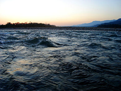
The river flows through Bhutan in a south-west direction between two ranges of the Lower Himalayas in V-shaped gorges and enters into Assam in India into the south-central foot hills of the Himalayas. The valley opens up in the foot hills; marked by the formation of swamps and marshes in the plains. The upper catchment is snow bound while the middle and lower catchment are thickly forested.[9]