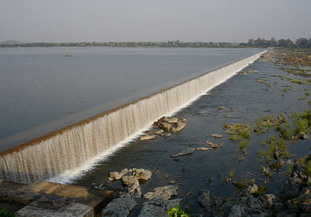
Godavari River

The Godavari is India’s second longest river after the Ganga. Its source is in Triambakeshwar, Maharashtra.[3] It flows east for 1,465 kilometres (910 mi), draining the states of Maharashtra (48.6%), Telangana (18.8%), Andhra Pradesh (4.5%), Chhattisgarh (10.9%) and Odisha (5.7%). The river ultimately empties into the Bay of Bengal through an extensive network of tributaries.[4] Measuring up to 312,812 km2 (120,777 sq mi), it forms one of the largest river basins in the Indian subcontinent, with only the Ganga and Indus rivers having a larger drainage basin.[5] In terms of length, catchment area and discharge, the Godavari is the largest in peninsular India, and had been dubbed as the Dakshina Ganga (Ganges of the South).[6]
The river has been revered in Hindu scriptures for many millennia and continues to harbour and nourish a rich cultural heritage. In the past few decades, the river has been barricaded by several barrages and dams, keeping a head of water (depth) which lowers evaporation. Its broad river delta houses 729 persons/km2 – nearly twice the Indian average population density and has a substantial risk of flooding, which in lower parts would be exacerbated if the global sea level were to rise.[7][8]
The Godavari originates in the Western Ghats of central India near Nashik in Maharashtra, 80 km (50 mi) from the Arabian Sea. It flows for 1,465 km (910 mi), first eastwards across the Deccan Plateau then turns southeast, entering the West Godavari district and East Godavari district of Andhra Pradesh, until it splits into two distributaries that widen into a large river delta at Sir Arthur Cotton Barrage in Rajamahendravaram and flow into the Bay of Bengal.[10]
The Godavari River has a coverage area of 312,812 km2 (120,777 sq mi), which is nearly one-tenth of the area of India and is greater than the areas of England and Ireland put together.
