Kafue River
The Kafue River is the longest river lying wholly within Zambia at about 1,576 kilometres (979 mi) long.[1] Its water is used for irrigation and for hydroelectric power.[2] It is the largest tributary of the Zambezi,[3] and of Zambia’s principal rivers, it is the most central and the most urban. More than 50% of Zambia’s population live in the Kafue River Basin and of these around 65% are urban.[1]
It has a mean flow rate of 320 m³/s through its lower half, with high seasonal variations. The river discharges 10 km³ per year into the Zambezi River.[4]
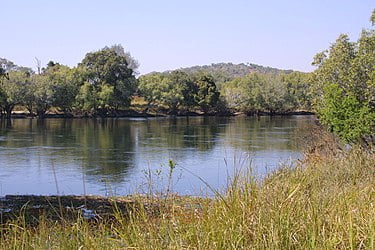
The Kafue River rises at an elevation of 1350 m on the relatively flat plateau just south the border between Zambia and the Democratic Republic of the Congo 120 km north-west of Chingola in the Copperbelt Province. The source of the Kafue River is in the North-western Province of Zambia. The area is Miombo woodland on the Congo-Zambezi watershed, with many branching dambos lying 10 to 20 m lower than the highest ground, producing a very gently undulating topography.
The river starts as a trickle from the marshy dambos (the Munyanshi Swamp is a tributary) and with little slope to speed up river flow, it meanders south-eastwards sluggishly and within 50 km has the character of a mature river.
The area receives about 1200 mm of rain in the rainy season, and the river’s channel soon reaches 100 m wide with a floodplain of fluvial dambos 1–2 km wide.[5]