River Colne, Hertfordshire
The Colne is a river and a tributary of the River Thames in England. Just over half its course is in south Hertfordshire. Downstream, it forms the boundary between the South Bucks district of Buckinghamshire and the London Borough of Hillingdon. The confluence with the River Thames is on the Staines reach (above Penton Hook Lock) at Staines-upon-Thames.
Two of its distributaries, constructed in the 1600 – 1750 period largely for aesthetic reasons for Hampton Court and for Syon Park, have been maintained. Their main purpose was not drinking water but these can be likened to the New River in scale and in date. Crossing its route, many viaducts and a canal, the intersecting Grand Union Canal, have been recognised for pioneering engineering during the Industrial Revolution.
Digging for gravel and clay along its lower course near Rickmansworth has created a belt of flooded pits below the water table, as established lakes, many of which are well-adapted habitats for wildlife, protected as nature reserves. The river, meadows and lakes form the Colne Valley regional park covering 43 square miles (110 km2).
The Colne becomes universally so-named after two close subterranean streams converge at a spring, or in very wet weather in the meadows above, all along the east side (Tollgate Road) of North Mymms Park in Hertfordshire. The source streams are long, multi-source, in final, northern stages, partly underground tributaries: a north-eastern, which can be considered the upper Colne; and the Mimmshall Brook.
Their main sources are 2.5 to 4 mi (4.0 to 6.4 km): in western Northaw, Brookmans Park, Hadley, London and Borehamwood, draining much of those places.[1] A seasonal, intra-parochial stream runs under the seven-building village of North Mymms draining most of the park, which, with adjoining woods is a small square plateau, sloping down to its corners except the south-west.
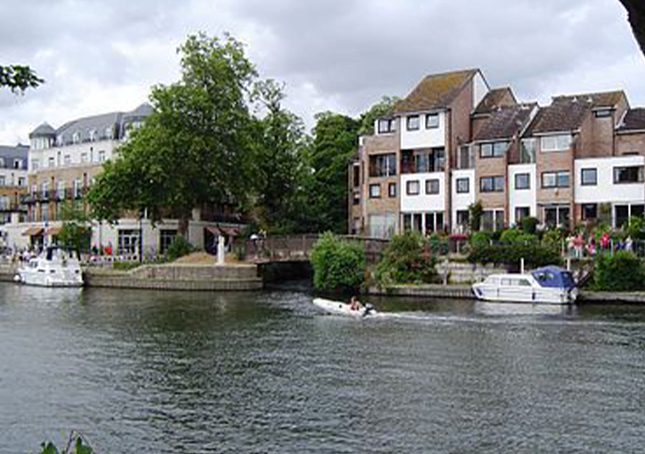
Shallow swallow holes of the two brooks are in North Mymms’ Water End, centred on so-named combined surface flow. From the Water End Swallow Holes the Colne runs west, longer NNW, then west then receives the Ellen Brook and turns SSW, then meanders south-west, bounding central and residential Watford and Oxhey, also bounding Rickmansworth and Batchworth, then for a similar total stretch bounding Greater London (and Spelthorne), east and (through anabranch ditches) Buckinghamshire, west.
Specifically, it passes between West Hyde, near Maple Cross, and Harefield, passes Denham Green then passes Uxbridge, where it parallels the Grand Union Canal and its first main anabranch, the Frays River which is co-fed by the Pinn between Cowley and Yiewsley, Greater London. The Colne Brook splits off as a distributary between New Denham and Uxbridge. After this, at West Drayton, the Frays rejoins and the Wraysbury River, the second main anabranch, and Duke of Northumberland’s River divide off.
Soon after, at Longford, the intake is given to the Longford River, a 12-mile (19 km) artificial channel created in 1610 for King Charles I to supply the water features in Bushy Park and the rectangular lakes in Hampton Court Park.
The Colne’s drainage basin extends almost as far north again as its northern limit – the inflowing Gade, Ver and Misbourne extend well into the Chilterns. Opposite, the other 2⁄3 of outer west and north-west London is drained by the Pymmes Brook, Brent, or Crane sub-basins of the Thames. In the north-west, centred on Tring’s northern boundary the Chiltern ridge is most noticeable, a watershed of this basin and that of the River Great Ouse, north and east towards the Wash.