Swakop River
The Swakop River (Khoekhoe: Tsoaxaub)[1] is a major river in western central Namibia. Its river source is in the Khomas Highland. From there it flows westwards through the town of Okahandja, the historic mission station at Gross Barmen, and the settlement of Otjimbingwe. It then crosses the Namib desert and reaches the Atlantic Ocean at Swakopmund (German: Mouth of the Swakop). The Swakop is an ephemeral river; its run-off is roughly 40 million cubic metres per annum.[2]
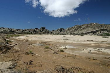
The Swakop River, along with its main tributary Khan, is one of the largest temporary water-bearing rivers in the dry western part of Namibia. It is 460 km (290 mi) long and has a 30,100 km2 (11,600 sq mi) large catchment area (including its tributaries).[3] The name comes from the Khoekhoe languages of the Nama and Damara Tsoa-xaub. Tsoa means ‘excrement opening’ or ‘anus‘ while xaub stands for the ‘contents of excrement.’ This name derives from the observation that the flow of large amounts of brownish sludge in the rain with it and discharges into the Atlantic Ocean.
The area around the river mouth and the surrounding dunes are also known for rich bird life and some unusual plant species (like the Welwitschia) that use the regular fog drifting in from the sea to sustain themselves in the absence of other moisture.
Groundwater levels in the area have also dropped about 0.3 m further due to the presence of two big dams built on the Swakop River.[4]
Notwithstanding the river’s irregular flow, some agriculture is undertaken in the Swakop River valley, thus the region is well known for its fresh produce, especially tomatoes, asparagus and olives. There are some fears of salt and uranium (possibly natural, possibly from the Rössing uranium mine) endangering this farming industry.[4][5]