Gambia River
The Gambia River (formerly known as the River Gambra) is a major river in West Africa, running 1,120 kilometres (700 mi) from the Fouta Djallon plateau in north Guinea westward through Senegal and The Gambia to the Atlantic Ocean at the city of Banjul. It is navigable for about half that length.
The river is strongly associated with The Gambia, the smallest country in mainland Africa, which consists of little more than the downstream half of the river and its two banks.
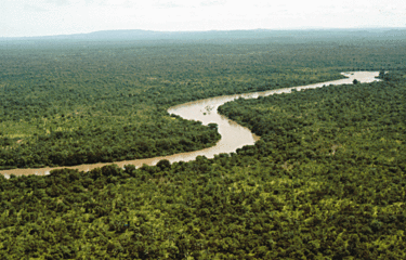
From the Fouta Djallon, the river runs northwest into the Tambacounda Region of Senegal, where it flows through the Parc National du Niokolo Koba, then is joined by the Nieri Ko and Koulountou [fr] before entering the Gambia at Fatoto. At this point, the river runs generally west, but in a meandering course with a number of oxbows, and about 100km from its mouth it gradually widens, to over 10km wide where it meets the sea.
As of 2020, there is only one fixed-link crossing of the river, the Senegambia Bridge near the towns of Farafenni and Soma in The Gambia. Opened in January 2019, it provides a link between the stretches of the Trans-Gambia Highway on the North and South Bank of the river. It also provides an expedited connection for Senegalese trucks traveling to and from Casamance. The bridge is 1.9 kilometers long and replaces a previously-unreliable vehicle ferry. A toll is levied on vehicle crossings.
All other crossings within the Gambia are done by ferry, including a primary crossing between Banjul and Barra at the mouth of the river.