Nura (river)
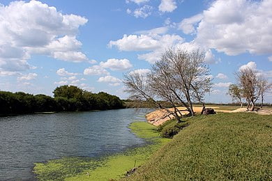
The Nura (Kazakh: Нұра, Nura; Russian: Нура) is a major watercourse of northeast-central Kazakhstan. It is 978 kilometres (608 mi) long and drains an area of 60,800 square kilometres (23,500 sq mi).[1]
The river rises in the Kyzyltas Mountains and flows initially north-northwestwards for about 100 kilometres (62 mi). It then turns to the west and flows in that direction for 220 kilometres (140 mi), then southwest for 180 kilometres (110 mi).
The Nura turns north near Esengeldi for about 200 kilometres (120 mi), eventually turning southwest as it draws close to Nur-Sultan near the river Irtysh. From there, it flows southwest for almost 300 miles (480 km), through a series of lakes, finally ending in the endorheic Lake Tengiz. The river’s largest tributaries are the Sherubainura, Ulkenkundyzdy, and Akbastau rivers. It is heavily used for irrigation and municipal water supply.[2] The average discharge at the mouth is 28.39 cubic metres per second (1,003 cu ft/s).[3]
The Irtysh–Karaganda Canal crosses the Nura at WikiMiniAtlas50°05′26″N 73°22′40″E, in what appears to be a tunnel. Some of the canals water is directed into the Nura (a chute below the dam at 50°5′30″N 73°22′37″E), replenishing this river.
The Samarkand Reservoir is constructed on the Nura downstream from the canal crossing (the dam is at 50°06′17″N 72°55′08″E), providing a waterfront for the city of Temirtau.