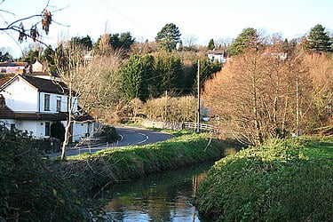
Land Yeo

The Land Yeo is a small river which flows through North Somerset, England.
It rises on Dundry Hill and supplies Barrow Gurney Reservoirs before flowing through various villages to Clevedon where it drains into the Bristol Channel. During the past 1,000 years it has powered at least ten watermills, however only one is still functional.
Since 2003 initiatives have been undertaken to clean up the river, improving water quality and encouraging wildlife.
The Land Yeo has its origins at several small springs on the western edge of Dundry Hill.[1] It is one of the small streams which feed Barrow Gurney Reservoirs near the village of Barrow Gurney, which provide drinking water for Bristol. It then flows through the village of Barrow Gurney alongside the B3130 road, where it can be seen in millponds.
It then flows north beneath the A370 road and the Bristol to Exeter railway line close to an old Roman settlement at Gatcombe. It then flows west past the Tyntesfield Estate, north of Nailsea where it is crossed by Jacklands Bridge and south of Wraxall, continuing through a man made watercourse, past Tickenham where it is the northern boundary of the Tickenham, Nailsea and Kenn Moors SSSI.
It then passes under the M5 motorway, through Clevedon where it joins the Middle Yeo and drains into the Bristol Channel.[1]
