Beverley Brook
Beverley Brook is a minor English river 14.3 km (8.9 mi) long in southwest London. It rises in Worcester Park and joins the River Thames to the north of Putney Embankment at Barn Elms.
Beverley Brook rises at the top of a hill in a shady area at Cuddington Recreation Ground in Worcester Park then flows north in a culvert under the A2043 road, emerging in waste land next to Worcester Park Station. It then flows northeast through Motspur Park, New Malden, Wimbledon Common, Richmond Park, forms the brief boundary of East Sheen and Roehampton near Priest’s Bridge, flows through the south of Barnes (bounding the Barnes playing fields to the north and Putney Common to the south) and joins the River Thames above Putney Embankment between Barn Elms, Barnes and Leader’s Gardens, Putney.[1][2]
Its basin has a catchment area of 64 km2 (25 sq mi).[3]
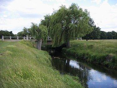
Beverley Brook creates a water feature used by deer, smaller animals and water grasses and some water lilies in Richmond Park (where it is followed by the Tamsin Trail and Beverley Walk). Then for the next 7 km (4.3 mi) upstream of Richmond Park, the Beverley Brook forms the historic South West London boundary,[4] now the boundary between the London Borough of Merton and the Royal Borough of Kingston upon Thames.
For the first 5 km (3.1 mi) south of Richmond Park, the six lane A3 trunk road from London to Portsmouth runs always within 300 m (980 ft) of the stream, crossing it three times. Although there is no point where the stream itself can be seen when driving along the road, the bridge parapets are visible and, for 2 km (1.2 mi), where the road runs along the edge of Wimbledon Common, the trees flanking the stream can be glimpsed across playing fields, with the lightly managed “natural” woodland of the common rising beyond. Except for the playing fields, the whole of the common, including Beverley Brook, is both a Site of Special Scientific Interest (SSSI)[5][6] and a Special Area of Conservation (SAC).[7] Towards the south (upstream) end of the common, Fishpond Wood and Beverley Meads nature reserve lies a few metres east of the stream.[8]